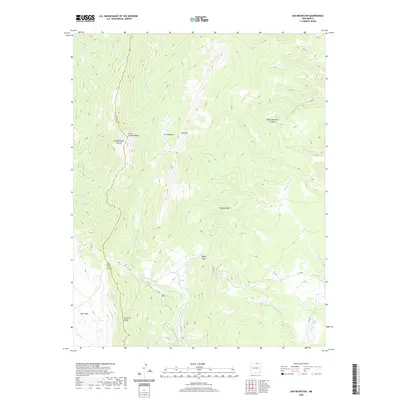
2020 Map of Ash Mountain
USGS Topo · Published 2020About this map
Little Costilla Peak and Ash Mtn dominate the skyline in this high-altitude section of the Cimarron Range, situated along the boundary between Taos and Colfax counties. This area is characterized by the expansive meadows of Valle Vidal, where numerous high-mountain streams like Leandro Cr and Middle Ponil Cr originate. The topography reveals significant geological features such as The Rock Wall and the passage at Windy Gap.
Find a feature on this map
30 named features on this map. Tap any name to fly to it.
Don’t see what you’re looking for? This feature index may not catch every label — zoom into the map to look around manually.
Map Details
Editions of this 2020 Ash Mountain Map
This is the sole edition of this map. No revisions or reprints were ever made.
Other maps of this area

1954 · Raton
USGS Topo · 1:250,000

1955 · Ute Park
USGS Topo · 1:62,500

1958 · Raton
USGS Topo · 1:250,000

1962 · Ash Mountain
USGS Topo · 1:62,500

1963 · Red River Pass
USGS Topo · 1:24,000

1963 · Comanche Point
USGS Topo · 1:24,000

1963 · Big Costilla Peak
USGS Topo · 1:24,000

1982 · Wheeler Peak
USGS Topo · 1:100,000
1986 · Vermejo Park
USGS Topo · 1:24,000
1986 · Van Bremmer Park
USGS Topo · 1:24,000