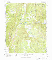
1962 Map of Ash Mountain
USGS Topo · Published 1977About this map
Beaubien and Miranda (Maxwell) land grant territory dominates this high-altitude landscape in northern Colfax County, just south of the Colorado state line. The terrain is defined by the sharp verticality of The Rock Wall and prominent summits like Vermejo Peak and Little Costilla Peak. Human presence in the early 1960s was characterized by isolated ranching outposts and hunting retreats, including Cressmer Lodge, Sharee Lodge, and the Bremmer Longshed Camp.
Find a feature on this map
69 named features on this map. Tap any name to fly to it.
Don’t see what you’re looking for? This feature index may not catch every label — zoom into the map to look around manually.
Map Details
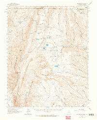
Editions of this 1962 Ash Mountain Map
3 editions found

Other maps of this area

1891 · Spanish Peaks
USGS Topo · 1:125,000

1893 · Spanish Peaks
USGS Topo · 1:125,000

1895 · Spanish Peaks
USGS Topo · 1:125,000

1897 · Spanish Peaks
USGS Topo · 1:125,000

1900 · Spanish Peaks
USGS Topo · 1:125,000

1954 · Raton
USGS Topo · 1:250,000

1954 · Trinidad
USGS Topo · 1:250,000

1955 · Cimarron
USGS Topo · 1:62,500

1955 · Ute Park
USGS Topo · 1:62,500

1955 · Trinidad
USGS Topo · 1:250,000