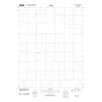
2009 Map of Ash Valley
USGS Topo · Published 2009About this map
Ash Valley serves as the central hub of this agricultural landscape in Pawnee County, where the topography is defined by the winding paths of intermittent waterways. The map details the local drainage system, particularly the meanders of Ash Creek and the path of Dry Walnut Creek in the northern reaches of the quadrangle. A strict section-line road grid, including routes like Harold Ave and Co Rd 340, organizes the rural space into the large tracts characteristic of Kansas farm country. For genealogists and local researchers, the Ash Valley Cemetery stands as a primary landmark, providing a specific point of reference for the families who settled and worked these plains during the early twenty-first century.
Find a feature on this map
6 named features on this map. Tap any name to fly to it.
Don’t see what you’re looking for? This feature index may not catch every label — zoom into the map to look around manually.
Map Details
Editions of this 2009 Ash Valley Map
This is the sole edition of this map. No revisions or reprints were ever made.
Other maps of this area

1889 · Larned
USGS Topo · 1:125,000

1891 · Larned
USGS Topo · 1:125,000

1955 · Great Bend
USGS Topo · 1:250,000

1957 · Great Bend
USGS Topo · 1:250,000

1958 · Great Bend
USGS Topo · 1:250,000
1965 · Albert
USGS Topo · 1:24,000

1966 · Rush Center
USGS Topo · 1:24,000
1966 · Timken
USGS Topo · 1:24,000

1970 · Fort Larned
USGS Topo · 1:24,000
1970 · Sanford
USGS Topo · 1:24,000