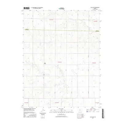
2015 Map of Ash Valley
USGS Topo · Published 2015About this map
Ash Valley serves as a central point in this rural landscape near the boundary of Rush Co and Pawnee Co. The area is defined by the subtle drainage patterns of Ash Cr and Dry Walnut Cr, which cut through the high plains of central Kansas. Genealogical interest centers on the Ash Valley Cem, located south of the main settlement area along 180th Ave. This survey illustrates the classic grid of the Public Land Survey System, with roads like Timken Rd and Harold Ave following section lines that have organized the regional agriculture for generations. The map documents the enduring rural character of the region, where wide-open sections and family farmsteads are connected by a network of gravel roads including Ave X and Ave Y.
Find a feature on this map
28 named features on this map. Tap any name to fly to it.
Don’t see what you’re looking for? This feature index may not catch every label — zoom into the map to look around manually.
Map Details
Editions of this 2015 Ash Valley Map
This is the sole edition of this map. No revisions or reprints were ever made.
Other maps of this area

1889 · Larned
USGS Topo · 1:125,000

1891 · Larned
USGS Topo · 1:125,000

1955 · Great Bend
USGS Topo · 1:250,000

1957 · Great Bend
USGS Topo · 1:250,000

1958 · Great Bend
USGS Topo · 1:250,000
1965 · Albert
USGS Topo · 1:24,000

1966 · Rush Center
USGS Topo · 1:24,000
1966 · Timken
USGS Topo · 1:24,000

1970 · Fort Larned
USGS Topo · 1:24,000
1970 · Sanford
USGS Topo · 1:24,000