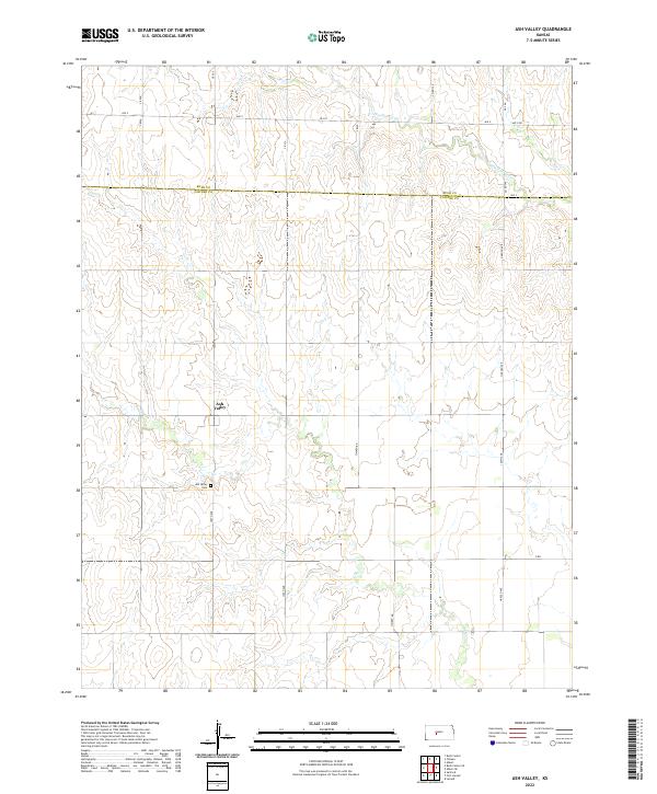
2022 Map of Ash Valley
USGS Topo · Published 2022About this map
Ash Valley serves as the central focal point of this Pawnee County landscape, situated just south of the Rush Co Pawnee Co line. The terrain is defined by the gentle drainage of Dry Walnut Creek in the northeast and a systematic network of section-line roads such as Timken Rd and Harold Ave. This modern survey illustrates the enduring agricultural layout of the region, where the original land survey system dictates the placement of homesteads and thoroughfares. Genealogists and local historians can find the Ash Valley Cem, a significant landmark for tracing the lineage of families who settled this part of the Kansas prairie. The map provides a clear view of the intersection between human settlement and the natural geography of the plains, where small clusters of buildings are spaced along gravel and dirt routes like Ave X and Ave Y.
Find a feature on this map
26 named features on this map. Tap any name to fly to it.
Don’t see what you’re looking for? This feature index may not catch every label — zoom into the map to look around manually.
Map Details
Editions of this 2022 Ash Valley Map
This is the sole edition of this map. No revisions or reprints were ever made.
Other maps of this area

1889 · Larned
USGS Topo · 1:125,000

1891 · Larned
USGS Topo · 1:125,000

1955 · Great Bend
USGS Topo · 1:250,000

1957 · Great Bend
USGS Topo · 1:250,000

1958 · Great Bend
USGS Topo · 1:250,000
1965 · Albert
USGS Topo · 1:24,000

1966 · Rush Center
USGS Topo · 1:24,000
1966 · Timken
USGS Topo · 1:24,000

1970 · Fort Larned
USGS Topo · 1:24,000
1970 · Sanford
USGS Topo · 1:24,000