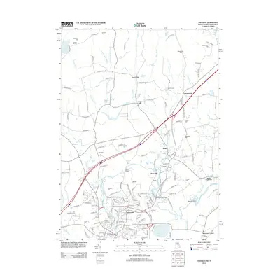
2012 Map of Ashaway
USGS Topo · Published 2012About this map
The Pawcatuck River corridor serves as the central artery for this borderland between Rhode Island and Connecticut, anchoring historic mill-era settlements like Stillmanville and Potter Hill. The map documents a landscape defined by its riparian economy, where the Ashaway River joins the Pawcatuck near Pawcatuck Bridge. Beyond the industrial centers, the terrain transitions into the upland heights of Champlin Hill and Brightman Hill, which are interspersed with numerous family and community landmarks. Genealogists will find a high density of burial sites preserved in the record, including the Friends Burial Ground, Pendleton Cem, and the Old Hopkinton Cemetery Rd. Further north, smaller villages such as Laurel Glen and Clarks Falls sit along the Green Fall River, illustrating the scattered settlement pattern typical of the region's inland brooks and ponds.
Find a feature on this map
160 named features on this map. Tap any name to fly to it.
Don’t see what you’re looking for? This feature index may not catch every label — zoom into the map to look around manually.
Map Details
Editions of this 2012 Ashaway Map
This is the sole edition of this map. No revisions or reprints were ever made.
Other maps of this area

1889 · Stonington
USGS Topo · 1:62,500

1889 · Charlestown
USGS Topo · 1:62,500

1889 · Moosup
USGS Topo · 1:62,500

1890 · Kent
USGS Topo · 1:62,500

1893 · Moosup
USGS Topo · 1:62,500

1893 · Stonington
USGS Topo · 1:62,500

1894 · Kent
USGS Topo · 1:62,500

1919 · Charlestown
USGS Topo · 1:62,500

1920 · Moosup
USGS Topo · 1:62,500

1921 · Charlestown
USGS Topo · 1:62,500