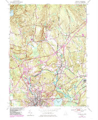
1984 Map of Ashaway
USGS Topo · Published 1985About this map
The Pawcatuck River winds through this mid-century landscape, serving as a natural divider and industrial heart for several riverfront communities. Settled clusters at Stillmanville, White Rock, and Potter Hill reflect the traditional Rhode Island pattern of river-based development, where mills often leveraged these specific bends in the water. To the north, the terrain transitions into the more sparsely populated hills of North Stonington and the forested reaches of the Pachaug State Forest.
Find a feature on this map
71 named features on this map. Tap any name to fly to it.
Don’t see what you’re looking for? This feature index may not catch every label — zoom into the map to look around manually.
Map Details
Editions of this 1984 Ashaway Map
2 editions found
Other maps of this area

1889 · Stonington
USGS Topo · 1:62,500

1889 · Charlestown
USGS Topo · 1:62,500

1889 · Moosup
USGS Topo · 1:62,500

1890 · Kent
USGS Topo · 1:62,500

1893 · Moosup
USGS Topo · 1:62,500

1893 · Stonington
USGS Topo · 1:62,500

1894 · Kent
USGS Topo · 1:62,500

1919 · Charlestown
USGS Topo · 1:62,500

1920 · Moosup
USGS Topo · 1:62,500

1921 · Charlestown
USGS Topo · 1:62,500