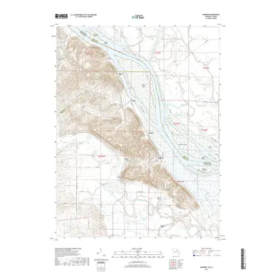
2017 Map of Ashburn
USGS Topo · Published 2017About this map
The Mississippi River and its complex network of sloughs and chutes dominate this landscape on the Missouri-Illinois border. The river valley is defined by numerous islands, including Jim Young Island, Gilbert Island, and Denmark Island, while the western bluffs provide a stark topographical contrast. Along these ridges and lowlands, the river economy is evident near the settlements of Ashburn and Busch. The Salt River cuts through the southern portion of the map, joining the Mississippi near Ashburn Bridge. Local history is preserved in several family and community burial grounds such as Schindler Cem, Robison Cem, and Ashburn Cem. Significant drainage infrastructure, like the Hadley McCraney Diversion Ditch and Hadley Ditch, illustrates the ongoing management of the floodplain for agriculture in the early 21st century.
Find a feature on this map
86 named features on this map. Tap any name to fly to it.
Don’t see what you’re looking for? This feature index may not catch every label — zoom into the map to look around manually.
Map Details
Editions of this 2017 Ashburn Map
This is the sole edition of this map. No revisions or reprints were ever made.
Other maps of this area

1890 · Louisiana
USGS Topo · 1:125,000

1931 · Barry
USGS Topo · 1:62,500

1932 · Hannibal
USGS Topo · 1:62,500

1936 · Hannibal
USGS Topo · 1:48,000

1936 · Barry
USGS Topo · 1:48,000

1937 · Bowling Green
USGS Topo · 1:62,500

1940 · Bowling Green
USGS Topo · 1:62,500

1943 · Vandalia
USGS Topo · 1:62,500

1944 · Barry
USGS Topo · 1:62,500

1945 · Hannibal
USGS Topo · 1:62,500