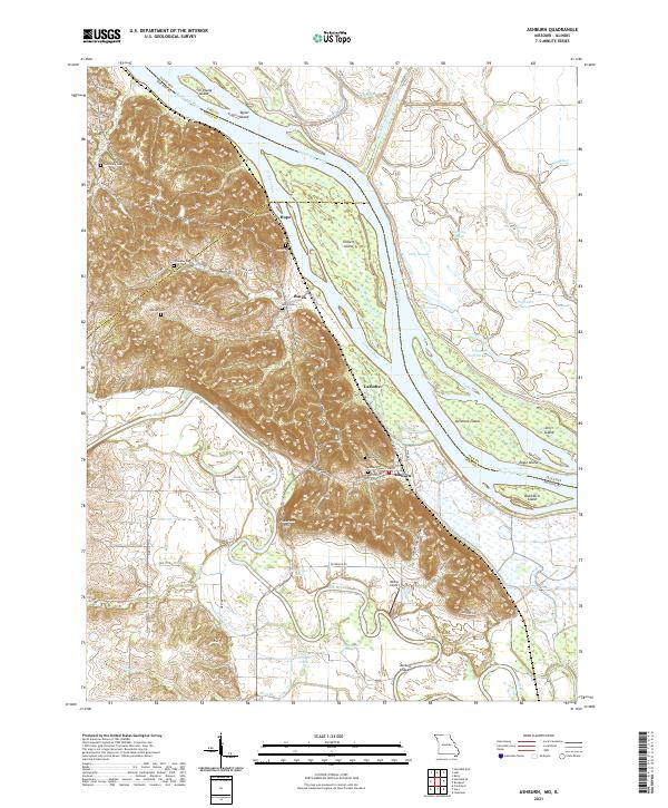
2021 Map of Ashburn
USGS Topo · Published 2021About this map
The Mississippi River corridor dominates this landscape, where the main channel is separated from a complex network of sloughs and backwaters by substantial landforms like Gilbert Island and Denmark Island. On the Missouri side, the confluence with the Salt River creates a dynamic wetland environment characterized by features like Horseshoe Lake and Cronican Slough. The topography shifts abruptly from these low-lying bottomlands to the elevated ridges of Pickerton Hill, dissected by drainage points such as Goose Gap Hollow and Happy Hollow.
Find a feature on this map
69 named features on this map. Tap any name to fly to it.
Don’t see what you’re looking for? This feature index may not catch every label — zoom into the map to look around manually.
Map Details
Editions of this 2021 Ashburn Map
This is the sole edition of this map. No revisions or reprints were ever made.
Other maps of this area

1890 · Louisiana
USGS Topo · 1:125,000

1931 · Barry
USGS Topo · 1:62,500

1932 · Hannibal
USGS Topo · 1:62,500

1936 · Hannibal
USGS Topo · 1:48,000

1936 · Barry
USGS Topo · 1:48,000

1937 · Bowling Green
USGS Topo · 1:62,500

1940 · Bowling Green
USGS Topo · 1:62,500

1943 · Vandalia
USGS Topo · 1:62,500

1944 · Barry
USGS Topo · 1:62,500

1945 · Hannibal
USGS Topo · 1:62,500