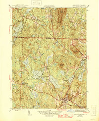
1946 Map of Ashburnham
USGS Topo · Published 1946About this map
Lake Monomonac and the surrounding borderlands between Massachusetts and New Hampshire define this 1940s landscape. The terrain is characterized by a dense concentration of glacial ponds and prominent elevations, such as Mount Watatic and Little Watatic Mountain, which dictate the winding paths of local roads like Ashby Rd. The Boston and Maine RR cuts through the southwestern corner, serving the area near Old North Ashburnham Sta.
Find a feature on this map
65 named features on this map. Tap any name to fly to it.
Don’t see what you’re looking for? This feature index may not catch every label — zoom into the map to look around manually.
Map Details
Editions of this 1946 Ashburnham Map
2 editions found
Other maps of this area

1887 · Winchendon
USGS Topo · 1:62,500

1887 · Fitchburg
USGS Topo · 1:62,500

1889 · Fitchburg
USGS Topo · 1:62,500

1890 · Winchendon
USGS Topo · 1:62,500

1893 · Fitchburg
USGS Topo · 1:62,500

1894 · Winchendon
USGS Topo · 1:62,500

1898 · Monadnock
USGS Topo · 1:62,500

1900 · Peterboro
USGS Topo · 1:62,500

1931 · Fitchburg
USGS Topo · 1:48,000

1932 · Winchendon
USGS Topo · 1:48,000