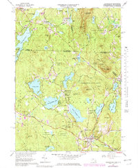
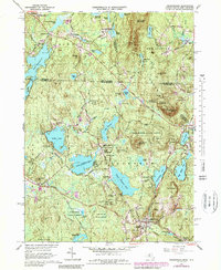
1965 Map of Ashburnham
USGS Topo · Published 1979About this map
Ashburnham serves as the focal point for this landscape straddling the Massachusetts and New Hampshire border, where the village center is defined by the prominent campus of Cushing Academy and The New Cem. The terrain is characterized by a series of high ridges and summits, including Mount Watatic and Little Watatic Mountain, which frame a complex network of glacial ponds and lakes. Water bodies such as Upper Naukeag Lake, Winnekeag Lake, and Lake Monomonac dominate the lowlands, connected by small waterways like Millers River.
Find a feature on this map
78 named features on this map. Tap any name to fly to it.
Don’t see what you’re looking for? This feature index may not catch every label — zoom into the map to look around manually.
Map Details
Editions of this 1965 Ashburnham Map
5 editions found
Other maps of this area

1887 · Winchendon
USGS Topo · 1:62,500

1887 · Fitchburg
USGS Topo · 1:62,500

1889 · Fitchburg
USGS Topo · 1:62,500

1890 · Winchendon
USGS Topo · 1:62,500

1893 · Fitchburg
USGS Topo · 1:62,500

1894 · Winchendon
USGS Topo · 1:62,500

1898 · Monadnock
USGS Topo · 1:62,500

1900 · Peterboro
USGS Topo · 1:62,500

1931 · Fitchburg
USGS Topo · 1:48,000

1932 · Winchendon
USGS Topo · 1:48,000