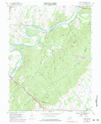
1970 Map of Ashby Gap
USGS Topo · Published 1983About this map
Ashby Gap serves as the central crossing point through the Blue Ridge on this topographic record, connecting the lowlands of Paris with the river valley to the west. The Shenandoah River snakes through the landscape, creating dramatic geographical features like Calmes Neck and Burwell Island. The map documents a rural network of named hollows and ridges, such as Slate Ridge and Duke Hollow, which dictated the early settlement patterns of small communities like Frogtown and Berrys. Historic infrastructure is well-represented, from the Norfolk and Western tracks in the northwest to the Castlemans Ferry Bridge and Byrd Bridge. Local genealogy and community history are anchored by several country churches, including Mountain Ch, Ebenezer Ch, and Mt Carmel Ch, along with the Providence Chapel Cem. On the eastern heights, the facility at Mt Weather stands at the border of Loudoun and Clarke counties.
Find a feature on this map
46 named features on this map. Tap any name to fly to it.
Don’t see what you’re looking for? This feature index may not catch every label — zoom into the map to look around manually.
Map Details
Editions of this 1970 Ashby Gap Map
4 editions found
Other maps of this area

1884 · Harpers Ferry
USGS Topo · 1:125,000

1891 · Harpers Ferry
USGS Topo · 1:125,000

1893 · Luray
USGS Topo · 1:125,000

1893 · Harpers Ferry
USGS Topo · 1:125,000

1894 · Warrenton
USGS Topo · 1:125,000

1894 · Winchester
USGS Topo · 1:125,000

1905 · Luray
USGS Topo · 1:125,000

1916 · Berryville
USGS Topo · 1:62,500

1938 · Winchester
USGS Topo · 1:48,000

1939 · Front Royal
USGS Topo · 1:48,000