
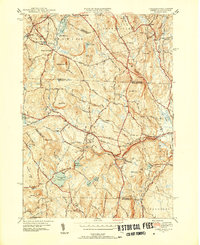
1950 Map of Ashby
USGS Topo · Published 1962About this map
The town of Ashby serves as the focal point of this mid-century survey, situated at the junction of State Highway 119 and the historic Ashby Turnpike. The landscape is defined by its transition from the Massachusetts uplands into southern New Hampshire, with the New Hampshire Massachusetts state line cutting across the northern portion of the sheet. Local life is anchored by small settlements like South Village and Smithville, while the Boston and Maine Railroad skirts the northeastern corner near Mason Sta. The area's water resources are prominently displayed through the Souhegan River and the significant Fitchburg Reservoir and Ashby Reservoir, which dominate the southern terrain. Notable historical landmarks include the Lyman Sch and the Glenwood Cem, providing specific touchpoints for genealogical research and local history. The topography is a dense network of named peaks, including Jones Hill and Blood Hill, illustrating the post-war rural character of Middlesex and Worcester Counties.
Find a feature on this map
53 named features on this map. Tap any name to fly to it.
Don’t see what you’re looking for? This feature index may not catch every label — zoom into the map to look around manually.
Map Details
Editions of this 1950 Ashby Map
4 editions found
Other maps of this area

1887 · Fitchburg
USGS Topo · 1:62,500

1889 · Fitchburg
USGS Topo · 1:62,500

1893 · Fitchburg
USGS Topo · 1:62,500

1893 · Groton
USGS Topo · 1:62,500

1900 · Peterboro
USGS Topo · 1:62,500

1906 · Milford
USGS Topo · 1:62,500

1931 · Groton
USGS Topo · 1:48,000

1931 · Fitchburg
USGS Topo · 1:48,000

1935 · Groton
USGS Topo · 1:62,500

1935 · Fitchburg
USGS Topo · 1:62,500