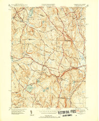
1950 Map of Ashby
USGS Topo · Published 1952About this map
The town of Ashby and the surrounding borderlands of Middlesex and Worcester counties are documented here just after the mid-century, reflecting a landscape defined by water power and upland farming. The terrain is notably hilly, with peaks like Blood Hill and Jewell Hill overlooking a network of brooks and reservoirs. The Fitchburg Reservoir and Ashby Reservoir anchor the southern portion of the sheet, while the northern edge tracks into New Hampshire, showing the Boston and Maine Railroad passing through Mason and Mason Sta. Local civic life is visible through features like the Lyman Sch, while the presence of Glenwood Cem and Burbank Cem provides essential data for genealogical research. Large tracts of protected land, including the Willard Brook State Forest and Townsend State Forest, suggest the transition of former agricultural lands and timber stands into the recreational and conservation areas that characterize the region today.
Find a feature on this map
76 named features on this map. Tap any name to fly to it.
Don’t see what you’re looking for? This feature index may not catch every label — zoom into the map to look around manually.
Map Details
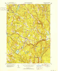
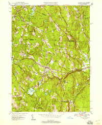
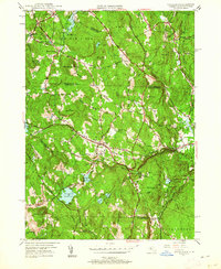
Editions of this 1950 Ashby Map
4 editions found
Other maps of this area

1887 · Fitchburg
USGS Topo · 1:62,500

1889 · Fitchburg
USGS Topo · 1:62,500

1893 · Fitchburg
USGS Topo · 1:62,500

1893 · Groton
USGS Topo · 1:62,500

1900 · Peterboro
USGS Topo · 1:62,500

1906 · Milford
USGS Topo · 1:62,500

1931 · Groton
USGS Topo · 1:48,000

1931 · Fitchburg
USGS Topo · 1:48,000

1935 · Groton
USGS Topo · 1:62,500

1935 · Fitchburg
USGS Topo · 1:62,500