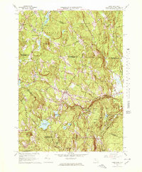
1965 Map of Ashby
USGS Topo · Published 1978About this map
Ashby serves as the central hub of this mid-1960s survey, where the convergence of Main Road and Turnpike Road marks the village's historic layout. The landscape is defined by its transition from the rolling hills of the New Hampshire border, featuring New Ipswich and Smithville, down into the dense woodlands of northern Massachusetts. The southern half of the map is dominated by managed wilderness and water resources, notably Willard Brook State Forest and the Fitchburg Reservoir. Significant local landmarks include Village Cem and Glenwood Cem, which provide essential touchpoints for genealogical research. The mapping of Gibson Road and Reed Road illustrates the persistent rural network connecting outlying clusters like Gibson Four Corners and South Village, reflecting a period of stable topography before modern development altered the region's character.
Find a feature on this map
65 named features on this map. Tap any name to fly to it.
Don’t see what you’re looking for? This feature index may not catch every label — zoom into the map to look around manually.
Map Details
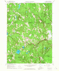
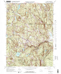
Editions of this 1965 Ashby Map
4 editions found

Other maps of this area

1887 · Fitchburg
USGS Topo · 1:62,500

1889 · Fitchburg
USGS Topo · 1:62,500

1893 · Fitchburg
USGS Topo · 1:62,500

1893 · Groton
USGS Topo · 1:62,500

1900 · Peterboro
USGS Topo · 1:62,500

1906 · Milford
USGS Topo · 1:62,500

1931 · Groton
USGS Topo · 1:48,000

1931 · Fitchburg
USGS Topo · 1:48,000

1935 · Groton
USGS Topo · 1:62,500

1935 · Fitchburg
USGS Topo · 1:62,500