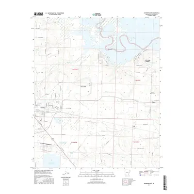
2017 Map of Ashdown East
USGS Topo · Published 2017About this map
The Little River meanders across this landscape, defining the boundaries and irrigation patterns of western Arkansas near the Oklahoma border. Ashdown serves as the regional hub, showing a grid of established streets such as Peyton Ave and East Main St. To the east, the sprawling waters of Millwood Lake dominate the northern terrain, creating a complex system of wetlands and islands like Jack Island. Local family history is rooted in the small settlements and rural cemeteries scattered throughout the quadrangle. Genealogists can find the Peytonville Cem near the community of Peytonville, along with the Cook Cem and Newsom Cem. The area’s industrial infrastructure is visible through features like the Nacoosa Paper Retention Pond and the SW Arkansas W D Holding Basin, reflecting the intersection of local industry and water management along Hudson Cr.
Find a feature on this map
98 named features on this map. Tap any name to fly to it.
Don’t see what you’re looking for? This feature index may not catch every label — zoom into the map to look around manually.
Map Details
Editions of this 2017 Ashdown East Map
This is the sole edition of this map. No revisions or reprints were ever made.
Other maps of this area

1950 · Ashdown East
USGS Topo · 1:24,000

1950 · Ashdown West
USGS Topo · 1:24,000

1950 · Ogden
USGS Topo · 1:24,000

1950 · Red Bluff
USGS Topo · 1:24,000

1950 · Ben Lomond
USGS Topo · 1:24,000

1950 · Barkman
USGS Topo · 1:24,000

1950 · Falls Chapel
USGS Topo · 1:24,000

1951 · Ben Lomond
USGS Topo · 1:24,000

1951 · Ashdown West
USGS Topo · 1:24,000

1951 · Ogden
USGS Topo · 1:24,000