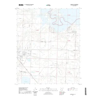
2020 Map of Ashdown East
USGS Topo · Published 2020About this map
The county seat of Ashdown anchors the western edge of this landscape, where residential streets like Peacock Dr and Lakewood Dr transition into the rural reaches of eastern Little River County. The hydrology of the region is defined by the winding course of the Little River, which feeds into the expanse of Millwood Lake in the northeast. This proximity to the river system is reflected in the numerous water bodies and drainage basins across the sheet, including Jack Island and the SW Arkansas W D Holding Basin.
Find a feature on this map
96 named features on this map. Tap any name to fly to it.
Don’t see what you’re looking for? This feature index may not catch every label — zoom into the map to look around manually.
Map Details
Editions of this 2020 Ashdown East Map
This is the sole edition of this map. No revisions or reprints were ever made.
Other maps of this area

1950 · Ashdown East
USGS Topo · 1:24,000

1950 · Ashdown West
USGS Topo · 1:24,000

1950 · Ogden
USGS Topo · 1:24,000

1950 · Red Bluff
USGS Topo · 1:24,000

1950 · Ben Lomond
USGS Topo · 1:24,000

1950 · Barkman
USGS Topo · 1:24,000

1950 · Falls Chapel
USGS Topo · 1:24,000

1951 · Ben Lomond
USGS Topo · 1:24,000

1951 · Ashdown West
USGS Topo · 1:24,000

1951 · Ogden
USGS Topo · 1:24,000