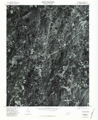
1980 Map of Asheboro
USGS Topo · Published 1983About this map
Asheboro serves as the focal point of this 1980 aerial survey, appearing as a dense concentration of residential streets and commercial corridors during a period of significant regional growth. The orthophoto format provides a rare, literal view of the landscape that traditional line-drawn maps cannot replicate, showing the precise density of the forest canopy and the exact footprint of industrial sites and neighborhoods.
Find a feature on this map
7 named features on this map. Tap any name to fly to it.
Don’t see what you’re looking for? This feature index may not catch every label — zoom into the map to look around manually.
Map Details
Editions of this 1980 Asheboro Map
This is the sole edition of this map. No revisions or reprints were ever made.
Other maps of this area

1953 · Raleigh
USGS Topo · 1:250,000

1954 · Raleigh
USGS Topo · 1:250,000

1957 · Asheboro
USGS Topo · 1:62,500

1968 · Ramseur
USGS Topo · 1:24,000

1968 · Erect
USGS Topo · 1:24,000

1970 · Randleman
USGS Topo · 1:24,000
1970 · Glenola
USGS Topo · 1:24,000

1970 · Asheboro
USGS Topo · 1:24,000
1973 · Eleazer
USGS Topo · 1:24,000

1973 · Seagrove
USGS Topo · 1:24,000