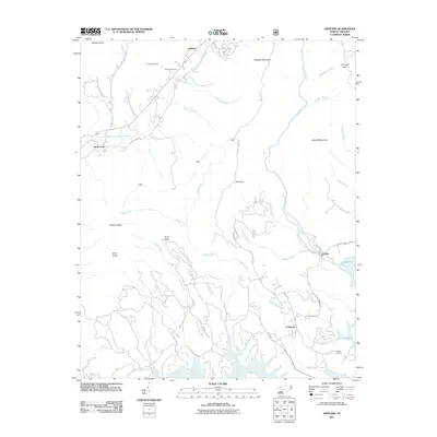
2011 Map of Ashford
USGS Topo · Published 2011About this map
Ashford and North Cove sit at the western edge of this 2011 survey, where the North Fork Catawba River begins its descent through the Blue Ridge foothills. The landscape is defined by the significant elevation changes between Shortoff Mountain and the deep drainage basins of Paddy Creek and Dales Creek. A striking engineering feature is the Honeycutt Tunnel, which passes through the high ground near Brown Cemetery as railroads and roads navigate the winding topography. In the southeast, the shoreline of Lake James creates a complex jagged boundary near the settlement of Longtown. The convergence of the Linville River and the Catawba River at the lake's northern reaches highlights the area's role as a major watershed. Detailed road labels like Old NC 105 and Wolf Pit Rd provide a clear view of how modern transportation corridors follow historic mountain passes and ridges.
Find a feature on this map
46 named features on this map. Tap any name to fly to it.
Don’t see what you’re looking for? This feature index may not catch every label — zoom into the map to look around manually.
Map Details
Editions of this 2011 Ashford Map
This is the sole edition of this map. No revisions or reprints were ever made.
Other maps of this area

1900 · Mount Mitchell
USGS Topo · 1:125,000

1902 · Mount Mitchell
USGS Topo · 1:125,000

1905 · Morganton
USGS Topo · 1:125,000

1934 · Spruce Pine
USGS Topo · 1:24,000

1934 · Linville Falls
USGS Topo · 1:24,000

1953 · Charlotte
USGS Topo · 1:250,000

1954 · Charlotte
USGS Topo · 1:250,000

1955 · Knoxville
USGS Topo · 1:250,000

1956 · Oak Hill
USGS Topo · 1:24,000

1956 · Ashford
USGS Topo · 1:24,000