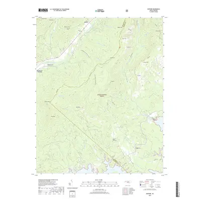
2019 Map of Ashford
USGS Topo · Published 2019About this map
The Linville Gorge dominates the eastern portion of this landscape, where the Linville River carves through the terrain between Linville Mtn and Shortoff Mtn. This area within the Pisgah National Forest contains specialized geographical markers like Rock Jock and Pinch-In, illustrating the complex topography of the Blue Ridge mountains. To the south, the waters of Lake James reach into Black Bear Cove, marking the transition from high ridgelines to the reservoir system.
Find a feature on this map
50 named features on this map. Tap any name to fly to it.
Don’t see what you’re looking for? This feature index may not catch every label — zoom into the map to look around manually.
Map Details
Editions of this 2019 Ashford Map
This is the sole edition of this map. No revisions or reprints were ever made.
Other maps of this area

1900 · Mount Mitchell
USGS Topo · 1:125,000

1902 · Mount Mitchell
USGS Topo · 1:125,000

1905 · Morganton
USGS Topo · 1:125,000

1934 · Spruce Pine
USGS Topo · 1:24,000

1934 · Linville Falls
USGS Topo · 1:24,000

1953 · Charlotte
USGS Topo · 1:250,000

1954 · Charlotte
USGS Topo · 1:250,000

1955 · Knoxville
USGS Topo · 1:250,000

1956 · Oak Hill
USGS Topo · 1:24,000

1956 · Ashford
USGS Topo · 1:24,000