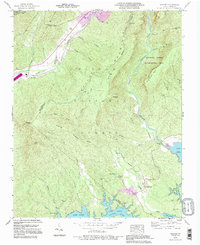
1993 Map of Ashford
USGS Topo · Published 1996About this map
Pisgah National Forest and the Linville Gorge Wilderness Area dominate this section of the Blue Ridge where the North Fork Catawba River and the Linville River descend toward the northern reaches of Lake James. The landscape is defined by the steep elevation changes between Honeycutt Mountain and the deep incision of the gorge, with the Blue Ridge Parkway skimming the northwestern corner. The settlement of Ashford serves as a local hub near the North Fork Catawba River, while the presence of the South Mtn Institute and Oak Grove Ch near Longtown indicates the established community centers in the lower elevations. Numerous family-named landmarks like Brown Cem and Obeth Cem provide vital points of interest for those tracing local lineages across this McDowell and Burke County border area.
Find a feature on this map
44 named features on this map. Tap any name to fly to it.
Don’t see what you’re looking for? This feature index may not catch every label — zoom into the map to look around manually.
Map Details
Editions of this 1993 Ashford Map
This is the sole edition of this map. No revisions or reprints were ever made.
Other maps of this area

1900 · Mount Mitchell
USGS Topo · 1:125,000

1902 · Mount Mitchell
USGS Topo · 1:125,000

1905 · Morganton
USGS Topo · 1:125,000

1934 · Spruce Pine
USGS Topo · 1:24,000

1934 · Linville Falls
USGS Topo · 1:24,000

1953 · Charlotte
USGS Topo · 1:250,000

1954 · Charlotte
USGS Topo · 1:250,000

1955 · Knoxville
USGS Topo · 1:250,000

1956 · Oak Hill
USGS Topo · 1:24,000

1956 · Ashford
USGS Topo · 1:24,000