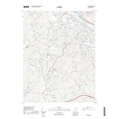
2019 Map of Ashland
USGS Topo · Published 2019About this map
The industrial and residential growth of the Ohio River valley is documented in this survey of Ashland and its neighboring Kentucky communities. The map detail highlights the densely settled neighborhoods of Westwood, Fairview, and West Fairview north of the city center, while tracing the southern expansion into Summit and Rockdale. A significant genealogical record is preserved through the numerous family and community burial grounds, ranging from the large Ashland Cemetery and Rose Hill Burial Park to smaller sites like Cumpston Cem and Patton Cem. The landscape is defined by its water systems, including the East Fork Little Sandy River and Grandview Lake in the southwest, and the Threemile Creek drainage system. A complex network of labeled road and rail corridors, such as the CS-2530 and CS-2050, reflects the historical importance of transportation in this river valley during the early 21st century.
Find a feature on this map
303 named features on this map. Tap any name to fly to it.
Don’t see what you’re looking for? This feature index may not catch every label — zoom into the map to look around manually.
Map Details
Editions of this 2019 Ashland Map
This is the sole edition of this map. No revisions or reprints were ever made.
Other maps of this area

1898 · Ironton
USGS Topo · 1:62,500

1900 · Ironton
USGS Topo · 1:62,500

1901 · Ceredo
USGS Topo · 1:62,500

1903 · Kenova
USGS Topo · 1:125,000

1904 · Kenova
USGS Topo · 1:125,000

1913 · Ceredo
USGS Topo · 1:62,500

1926 · Greenup
USGS Topo · 1:48,000

1930 · Greenup
USGS Topo · 1:62,500

1953 · Rush
USGS Topo · 1:24,000

1953 · Boltsfork
USGS Topo · 1:24,000