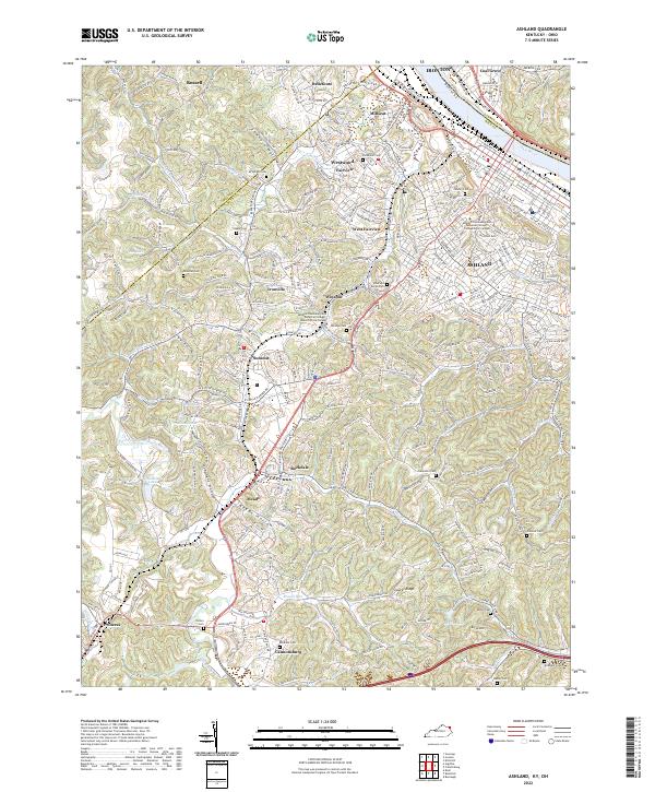
2022 Map of Ashland
USGS Topo · Published 2022About this map
The Ohio River frontage at Ashland anchors this topographic study, where the river serves as the state boundary between Kentucky and Ohio. Inland, the landscape is defined by the heavy dissection of the Cumberland Plateau, with numerous hollows like Lawhorn Hollow and Stephens Hollow dictating the path of local development. This 2022 survey documents the contemporary extent of suburban communities such as Westwood, Fairview, and Winslow, as well as industrial and educational hubs like the Ashland Community and Technical College Roberts Drive Campus.
Find a feature on this map
58 named features on this map. Tap any name to fly to it.
Don’t see what you’re looking for? This feature index may not catch every label — zoom into the map to look around manually.
Map Details
Editions of this 2022 Ashland Map
This is the sole edition of this map. No revisions or reprints were ever made.
Other maps of this area

1898 · Ironton
USGS Topo · 1:62,500

1900 · Ironton
USGS Topo · 1:62,500

1901 · Ceredo
USGS Topo · 1:62,500

1903 · Kenova
USGS Topo · 1:125,000

1904 · Kenova
USGS Topo · 1:125,000

1913 · Ceredo
USGS Topo · 1:62,500

1926 · Greenup
USGS Topo · 1:48,000

1930 · Greenup
USGS Topo · 1:62,500

1953 · Rush
USGS Topo · 1:24,000

1953 · Boltsfork
USGS Topo · 1:24,000