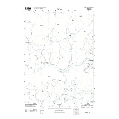
2013 Map of Ashland
USGS Topo · Published 2013About this map
Batavia Kill carves a deep valley through the high peaks of the Catskills, anchoring the settlements of Ashland and Windham in a landscape defined by dramatic elevation. The northern reaches are dominated by Huntersfield Mountain and South Mountain, where the terrain rises sharply from the creek beds. This 2013 survey illustrates a region where local heritage is preserved in numerous family and community burial grounds, including the Peck Family Cem and N Settlement Cem. While the lower elevations support agricultural and commercial interests like Kerns Nursery, the higher slopes are increasingly dedicated to recreation and conservation, evidenced by the Windham Ski Area and Bald Mountain Tree Farm. This documentation of Greene County shows a persistent pattern of high-altitude settlement at West Settlement and Sutton Hollow, connected by a winding network of mountain roads.
Find a feature on this map
131 named features on this map. Tap any name to fly to it.
Don’t see what you’re looking for? This feature index may not catch every label — zoom into the map to look around manually.
Map Details
Editions of this 2013 Ashland Map
This is the sole edition of this map. No revisions or reprints were ever made.
Other maps of this area

1892 · Kaaterskill
USGS Topo · 1:62,500

1893 · Kaaterskill
USGS Topo · 1:62,500

1893 · Durham
USGS Topo · 1:62,500

1894 · Kaaterskill
USGS Topo · 1:62,500

1894 · Durham
USGS Topo · 1:62,500

1899 · Kaaterskill
USGS Topo · 1:62,500

1900 · Phoenicia
USGS Topo · 1:62,500

1901 · Gilboa
USGS Topo · 1:62,500

1903 · Gilboa
USGS Topo · 1:62,500

1903 · Phoenicia
USGS Topo · 1:62,500