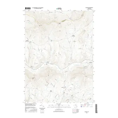
2016 Map of Ashland
USGS Topo · Published 2016About this map
Ashland and the surrounding high country of the Greene Co and Schoharie Co border are defined by deep valleys carved by the Batavia Kill and East Kill. This landscape is marked by a network of rural settlements, including West Settlement, North Settlement, and Jewett, each tied to the winding roads that follow the contours of peaks like Huntersfield Mtn and Ashland Pinnacle. The placement of numerous burial grounds, such as the Saint Joseph's Chapel Cem and Peck Family Cem, suggests a long-standing pattern of family-centered land ownership in these mountain hollows. The transport network relies heavily on historically named routes like Mail Route Rd and Sutton Hollow Rd, which connect the scattered homesteads and community centers across the ridgelines. Waterways such as Roaring Brook and John Chase Brook provide the primary drainage for the steep terrain, illustrating the geographic constraints that shaped the development of Mill Hollow and West Jewett.
Find a feature on this map
98 named features on this map. Tap any name to fly to it.
Don’t see what you’re looking for? This feature index may not catch every label — zoom into the map to look around manually.
Map Details
Editions of this 2016 Ashland Map
This is the sole edition of this map. No revisions or reprints were ever made.
Other maps of this area

1892 · Kaaterskill
USGS Topo · 1:62,500

1893 · Kaaterskill
USGS Topo · 1:62,500

1893 · Durham
USGS Topo · 1:62,500

1894 · Kaaterskill
USGS Topo · 1:62,500

1894 · Durham
USGS Topo · 1:62,500

1899 · Kaaterskill
USGS Topo · 1:62,500

1900 · Phoenicia
USGS Topo · 1:62,500

1901 · Gilboa
USGS Topo · 1:62,500

1903 · Gilboa
USGS Topo · 1:62,500

1903 · Phoenicia
USGS Topo · 1:62,500