1975 Map of Ashland NE
USGS Topo · Published 1981About this map
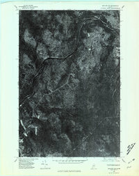
Aroostook River curves through this mid-1970s orthophotoquad, serving as the central geographic feature for the remote woodlands of northern Maine. This specific format uses rectified aerial imagery to provide a photographic view of the landscape rather than traditional topographic symbols. The settlement at Frenchville appears as a small cluster of structures and cleared land amidst the heavy forest cover, reflecting the region's long history of isolated agricultural and timber-based economies. In the southern half of the sheet, the terrain gives way to low-lying water features, including Mud Pond and the winding course of Alder Brook. The sharp contrast between the geometric patterns of cleared fields and the irregular texture of the deep Maine woods reveals the ongoing human footprint on the edge of the wilderness.
Find a feature on this map
4 named features on this map. Tap any name to fly to it.
Don’t see what you’re looking for? This feature index may not catch every label — zoom into the map to look around manually.
Map Details
Editions of this 1975 Ashland NE Map
This is the sole edition of this map. No revisions or reprints were ever made.
Other maps of this area

1929 · Portage
USGS Topo · 1:62,500

1929 · Caribou
USGS Topo · 1:48,000

1931 · Ashland
USGS Topo · 1:48,000

1931 · Portage
USGS Topo · 1:62,500

1932 · Caribou
USGS Topo · 1:62,500

1934 · Ashland
USGS Topo · 1:62,500

1935 · Presque Isle
USGS Topo · 1:62,500

1953 · Ashland
USGS Topo · 1:62,500

1953 · Portage
USGS Topo · 1:62,500

1953 · Presque Isle
USGS Topo · 1:62,500