
1953 Map of Portage
USGS Topo · Published 1955About this map
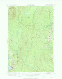
The town of Portage serves as the focal point of this 1953 survey, situated along the Bangor and Aroostook railroad and the southern shores of Portage Lake. The landscape reflects a deeply integrated timber and wilderness economy, marked by numerous seasonal outposts such as Bolstridge Camp, Guerette Camp, and Hoit Camp. Long-established industrial sites like the Old Shingle Mill on McClusky Bk provide evidence of early 20th-century logging practices in the North Maine Woods. Monitoring this heavily forested terrain are high-elevation lookouts, including the Story Hill Fire Tower and Three Brooks Fire Tower atop Pennington Mtn. Navigating the area relies on a network of traditional routes like the Nixon Trail and the Old Chain Bridge, while local genealogy is grounded at sites like Buffalo Cem.
Find a feature on this map
69 named features on this map. Tap any name to fly to it.
Don’t see what you’re looking for? This feature index may not catch every label — zoom into the map to look around manually.
Map Details
Editions of this 1953 Portage Map
4 editions found
Other maps of this area

1927 · Stockholm
USGS Topo · 1:48,000

1927 · Square Lake
USGS Topo · 1:48,000

1928 · Eagle Lake
USGS Topo · 1:48,000

1928 · Winterville
USGS Topo · 1:48,000

1929 · Portage
USGS Topo · 1:62,500

1929 · Caribou
USGS Topo · 1:48,000

1930 · Greenlaw
USGS Topo · 1:48,000

1931 · Square Lake
USGS Topo · 1:62,500

1931 · Ashland
USGS Topo · 1:48,000

1931 · Eagle Lake
USGS Topo · 1:62,500