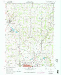
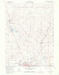
1961 Map of Ashland North
USGS Topo · Published 1973About this map
The northern reaches of Ashland and the surrounding farmland of north-central Ohio are meticulously detailed in this early 1960s survey, updated with late 1970s revisions. The landscape is defined by the historic division between the Congress Lands and the Western Reserve Ranges, a cadastral boundary that shaped the area's early settlement patterns. Transportation and water resources anchor the local economy, from the Erie-Lackawanna railroad tracks passing through Nankin to the municipal infrastructure of the Ashland Reservoir and the Filtration Plant. Small rural centers like Savannah and Bailey Lake appear alongside family-centric landmarks such as Rickert Cemetery and the Fast Cemetery. The transition from agrarian roots to mid-century development is evident in the presence of the Ashland County Airport and various gravel operations along Orange Creek and Leidigh Mill Creek, reflecting the region's industrial diversification while maintaining its traditional township structure.
Find a feature on this map
49 named features on this map. Tap any name to fly to it.
Don’t see what you’re looking for? This feature index may not catch every label — zoom into the map to look around manually.
Map Details
Editions of this 1961 Ashland North Map
5 editions found
Other maps of this area

1904 · Wellington
USGS Topo · 1:62,500

1906 · Wellington
USGS Topo · 1:62,500

1906 · West Salem
USGS Topo · 1:62,500

1908 · Ashland
USGS Topo · 1:62,500

1908 · West Salem
USGS Topo · 1:62,500

1908 · New London
USGS Topo · 1:62,500

1950 · Marion
USGS Topo · 1:250,000

1956 · Toledo
USGS Topo · 1:250,000

1960 · New London
USGS Topo · 1:24,000

1960 · Nova
USGS Topo · 1:24,000