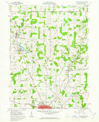
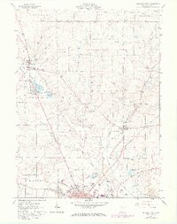
1961 Map of Ashland North
USGS Topo · Published 1963About this map
The northern reaches of Ashland serve as the focal point for this early 1960s survey, marking the transition from the city's expanding footprint into the agricultural township lands of Montgomery and Union. The Erie-Lackawanna railroad cuts a prominent path through the countryside, passing the small settlement of Nankin and several industrial Sand and Gravel Pits. This area is characterized by a high density of family-named burial grounds and local institutions, including the Rickert Cem, Fast Cem, and Maple Grove Ch, which provide valuable location data for genealogists tracing mid-century Ohio roots.
Find a feature on this map
45 named features on this map. Tap any name to fly to it.
Don’t see what you’re looking for? This feature index may not catch every label — zoom into the map to look around manually.
Map Details
Editions of this 1961 Ashland North Map
5 editions found
Other maps of this area

1904 · Wellington
USGS Topo · 1:62,500

1906 · Wellington
USGS Topo · 1:62,500

1906 · West Salem
USGS Topo · 1:62,500

1908 · Ashland
USGS Topo · 1:62,500

1908 · West Salem
USGS Topo · 1:62,500

1908 · New London
USGS Topo · 1:62,500

1950 · Marion
USGS Topo · 1:250,000

1956 · Toledo
USGS Topo · 1:250,000

1960 · New London
USGS Topo · 1:24,000

1960 · Nova
USGS Topo · 1:24,000