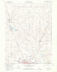
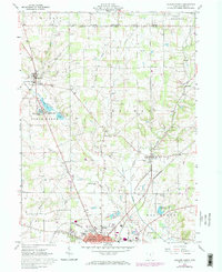
1961 Map of Ashland North
USGS Topo · Published 1973About this map
The agricultural landscape of north-central Ohio is meticulously recorded here, where the townships of Clear Creek, Orange, and Montgomery converge. The village of Savannah serves as a northern anchor, characterized by the Savannah-Clear Creek Sch and its proximity to the Vermilion River. Moving south, the terrain is defined by a series of glacial water bodies including Mud Lake and Spring Lake, collectively known as the Savannah Lakes.
Find a feature on this map
52 named features on this map. Tap any name to fly to it.
Don’t see what you’re looking for? This feature index may not catch every label — zoom into the map to look around manually.
Map Details
Editions of this 1961 Ashland North Map
5 editions found
Other maps of this area

1904 · Wellington
USGS Topo · 1:62,500

1906 · Wellington
USGS Topo · 1:62,500

1906 · West Salem
USGS Topo · 1:62,500

1908 · Ashland
USGS Topo · 1:62,500

1908 · West Salem
USGS Topo · 1:62,500

1908 · New London
USGS Topo · 1:62,500

1950 · Marion
USGS Topo · 1:250,000

1956 · Toledo
USGS Topo · 1:250,000

1960 · New London
USGS Topo · 1:24,000

1960 · Nova
USGS Topo · 1:24,000