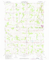
1960 Map of Nova
USGS Topo · Published 1974About this map
Rochester and Nova anchor this portrait of north-central Ohio, where the grid of the Connecticut Western Reserve is etched into the landscape. The survey details a rural economy defined by the crossing of the Penn Central and Baltimore and Ohio railroads, which once linked these small agricultural hubs to larger industrial markets. Waterways like the East Branch Black River and Charlemont Creek cut through the geometric township lines of Troy, Rochester, and Ruggles. Local history is preserved in the location of several burial grounds, including the Universalist Cem and various Township Cem sites, while the presence of Terrace Lake Park and a local Golf Course suggests the mid-century shift toward recreational land use in these traditional farming communities.
Find a feature on this map
31 named features on this map. Tap any name to fly to it.
Don’t see what you’re looking for? This feature index may not catch every label — zoom into the map to look around manually.
Map Details
Editions of this 1960 Nova Map
3 editions found

Other maps of this area

1904 · Wellington
USGS Topo · 1:62,500

1906 · Wellington
USGS Topo · 1:62,500

1906 · West Salem
USGS Topo · 1:62,500

1908 · Ashland
USGS Topo · 1:62,500

1908 · West Salem
USGS Topo · 1:62,500

1908 · New London
USGS Topo · 1:62,500

1950 · Marion
USGS Topo · 1:250,000

1956 · Toledo
USGS Topo · 1:250,000
1960 · Wellington
USGS Topo · 1:24,000

1960 · New London
USGS Topo · 1:24,000