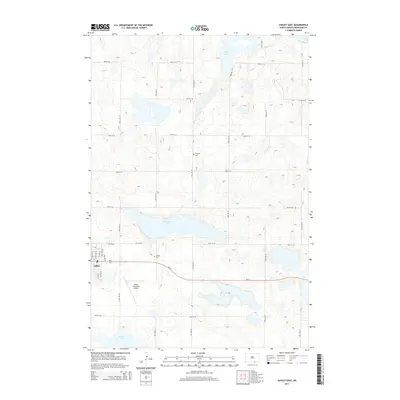
2014 Map of Ashley East
USGS Topo · Published 2014About this map
The city of Ashley anchors the southwestern portion of this McIntosh County landscape, situated where the local grid of streets like Center Ave N meets the regional path of ND-11. This area is characterized by its numerous natural basins, including the sizable Kislingburg Lake and Salt Lake, which reflect the typical prairie pothole geography of North Dakota. For those researching local history or genealogy, the map identifies specific burial grounds such as Ashley Cem on the outskirts of town and Emmans Cem further north along 51st Ave SE. Transportation and commerce are represented by the Ashley Municipal Airport south of the city, while the surrounding territory is divided by a systematic section-line road network, including long stretches of 90th St SE and 54th Ave SE that facilitate movement through the agricultural interior.
Find a feature on this map
29 named features on this map. Tap any name to fly to it.
Don’t see what you’re looking for? This feature index may not catch every label — zoom into the map to look around manually.
Map Details
Editions of this 2014 Ashley East Map
This is the sole edition of this map. No revisions or reprints were ever made.
Other maps of this area

1953 · Jamestown
USGS Topo · 1:250,000

1954 · Aberdeen
USGS Topo · 1:250,000

1956 · Aberdeen
USGS Topo · 1:250,000

1956 · Jamestown
USGS Topo · 1:250,000

1968 · Long Lake NW
USGS Topo · 1:24,000

1978 · Wolff Lake
USGS Topo · 1:24,000

1978 · Schumacher Lake NE
USGS Topo · 1:24,000

1982 · Coldwater Lake NW
USGS Topo · 1:24,000

1982 · Danzig
USGS Topo · 1:24,000

1982 · Ashley East
USGS Topo · 1:24,000