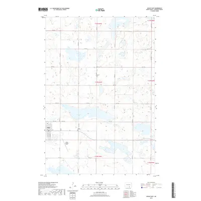
2018 Map of Ashley East
USGS Topo · Published 2018About this map
Ashley serves as the primary hub of this McIntosh County landscape, situated near the intersection of Center Ave S and several numbered streets including 1st Ave SE and 2nd Ave SE. The town's surrounding geography is defined by a dense network of prairie potholes and larger water bodies like Kislingburg Lake and Salt Lake. The agricultural character of the region is reflected in the organized grid of rural roads, such as 95th St SE and 50th Ave SE, which connect dispersed local sites. Genealogists and local historians can locate the Emmaus Cem and the Ashley City Cem on the outskirts of the settlement, while the Ashley Municipal Airport to the south indicates the area's modern infrastructure. The map illustrates a classic Great Plains transition where the residential streets of the town give way to the expansive wetlands of Tschetter Lake and the surrounding townships.
Find a feature on this map
29 named features on this map. Tap any name to fly to it.
Don’t see what you’re looking for? This feature index may not catch every label — zoom into the map to look around manually.
Map Details
Editions of this 2018 Ashley East Map
This is the sole edition of this map. No revisions or reprints were ever made.
Other maps of this area

1953 · Jamestown
USGS Topo · 1:250,000

1954 · Aberdeen
USGS Topo · 1:250,000

1956 · Aberdeen
USGS Topo · 1:250,000

1956 · Jamestown
USGS Topo · 1:250,000

1968 · Long Lake NW
USGS Topo · 1:24,000

1978 · Wolff Lake
USGS Topo · 1:24,000

1978 · Schumacher Lake NE
USGS Topo · 1:24,000

1982 · Coldwater Lake NW
USGS Topo · 1:24,000

1982 · Danzig
USGS Topo · 1:24,000

1982 · Ashley East
USGS Topo · 1:24,000