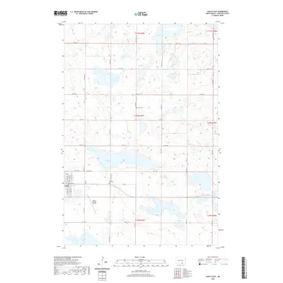
2020 Map of Ashley East
USGS Topo · Published 2020About this map
Ashley serves as the primary hub in this portion of McIntosh County, showing a well-defined grid oriented around E Main St and 7th St NE. The surrounding prairie is characterized by a high density of wetlands and glacial lakes, including the large expanse of Kislingburg Lake and the smaller Salt Lake to the north. These water bodies dictate the placement of the section-line road network, which includes routes such as 94th St SE and 97th St SE. For local historians and genealogists, the map identifies specific interment sites at Ashley City Cem on the edge of town and Emmaus Cem further north in the rural countryside. Transportation infrastructure is represented by the Ashley Municipal Airport, reflecting the region's continued reliance on aviation for agricultural and utility purposes in this expansive landscape.
Find a feature on this map
22 named features on this map. Tap any name to fly to it.
Don’t see what you’re looking for? This feature index may not catch every label — zoom into the map to look around manually.
Map Details
Editions of this 2020 Ashley East Map
This is the sole edition of this map. No revisions or reprints were ever made.
Other maps of this area

1953 · Jamestown
USGS Topo · 1:250,000

1954 · Aberdeen
USGS Topo · 1:250,000

1956 · Aberdeen
USGS Topo · 1:250,000

1956 · Jamestown
USGS Topo · 1:250,000

1968 · Long Lake NW
USGS Topo · 1:24,000

1978 · Wolff Lake
USGS Topo · 1:24,000

1978 · Schumacher Lake NE
USGS Topo · 1:24,000

1982 · Coldwater Lake NW
USGS Topo · 1:24,000

1982 · Danzig
USGS Topo · 1:24,000

1982 · Ashley East
USGS Topo · 1:24,000