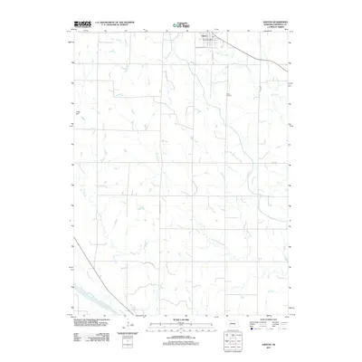
2011 Map of Ashton
USGS Topo · Published 2011About this map
Ashton serves as the primary hub in this Sherman County landscape, situated at the intersection of Center Ave and W Washington St. The village is centered around the Ashton Post Office, while the surrounding rural geography is defined by a dendritic network of waterways including Oak Creek and Deer Creek. To the south, the terrain descends toward the banks of the Middle Loup River, which cuts across the southwestern corner of the quadrangle. Local infrastructure is anchored by the Ashton-Rockville Rd, which provides a vital connection between the town and the agricultural lands to the south. Union Cemetery sits on a rise overlooking Oak Creek to the east, offering a focal point for genealogical research in the area, while Gregg Dam on Rock Creek represents a point of water management in the western portion of the region.
Find a feature on this map
12 named features on this map. Tap any name to fly to it.
Don’t see what you’re looking for? This feature index may not catch every label — zoom into the map to look around manually.
Map Details
Editions of this 2011 Ashton Map
This is the sole edition of this map. No revisions or reprints were ever made.
Other maps of this area

1899 · Loup
USGS Topo · 1:125,000

1953 · Cotesfield
USGS Topo · 1:24,000

1953 · Rockville
USGS Topo · 1:24,000

1953 · Boelus
USGS Topo · 1:24,000

1953 · Ravenna NW
USGS Topo · 1:24,000

1953 · Loup City SE
USGS Topo · 1:24,000

1953 · Loup City
USGS Topo · 1:24,000

1953 · Farwell
USGS Topo · 1:24,000

1953 · Ashton
USGS Topo · 1:24,000

1953 · Ravenna
USGS Topo · 1:24,000