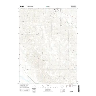
2014 Map of Ashton
USGS Topo · Published 2014About this map
Ashton serves as the central hub of this Sherman County landscape, situated amidst the complex drainage systems of the eastern Nebraska plains. The village is positioned near the northern edge of the map, where Oak Cr and its tributaries carve through the upland terrain. To the south, the topography descends toward the broad valley of the Middle Loup River, a significant waterway that defines the southwestern corner of the quadrangle. The agricultural character of the region is evident in the precise grid of section roads, including 787th Rd and Rockville Ave, which connect isolated farmsteads. Genealogists and local historians will find Union Cem located east of the main settlement, a quiet landmark in a landscape defined by the winding paths of Deer Cr and Rock Creek. This 2014 survey documents the modern road network, contrasting Old Highway 92 with the updated route of Ne-92.
Find a feature on this map
32 named features on this map. Tap any name to fly to it.
Don’t see what you’re looking for? This feature index may not catch every label — zoom into the map to look around manually.
Map Details
Editions of this 2014 Ashton Map
This is the sole edition of this map. No revisions or reprints were ever made.
Other maps of this area

1899 · Loup
USGS Topo · 1:125,000

1953 · Cotesfield
USGS Topo · 1:24,000

1953 · Rockville
USGS Topo · 1:24,000

1953 · Boelus
USGS Topo · 1:24,000

1953 · Ravenna NW
USGS Topo · 1:24,000

1953 · Loup City SE
USGS Topo · 1:24,000

1953 · Loup City
USGS Topo · 1:24,000

1953 · Farwell
USGS Topo · 1:24,000

1953 · Ashton
USGS Topo · 1:24,000

1953 · Ravenna
USGS Topo · 1:24,000