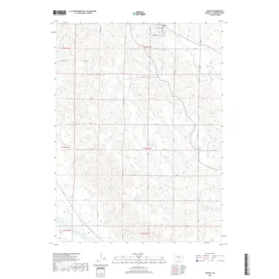
2017 Map of Ashton
USGS Topo · Published 2017About this map
Ashton anchors the northern edge of this Nebraska landscape, organized by a precise grid of rural routes including Rockville Ave and 787 Rd. The settlement is defined by residential streets such as W Carleton St and W Washington St, while the surrounding terrain is deeply carved by numerous drainages that feed into larger waterways. The southern boundary is marked by the wide channel of the Middle Loup River, which contrasts with the intricate seasonal creek systems like Oak Cr and Deer Cr that bisect the upland pastures. For those tracing local heritage, Union Cem is located east of the main north-south corridor, situated among the rolling breaks typical of Sherman County. Water management is evident at Gregg Reservoir in the northwest, reflecting the region's agricultural dependency on surface water collection in an area otherwise characterized by intermittent stream flow.
Find a feature on this map
32 named features on this map. Tap any name to fly to it.
Don’t see what you’re looking for? This feature index may not catch every label — zoom into the map to look around manually.
Map Details
Editions of this 2017 Ashton Map
This is the sole edition of this map. No revisions or reprints were ever made.
Other maps of this area

1899 · Loup
USGS Topo · 1:125,000

1953 · Cotesfield
USGS Topo · 1:24,000

1953 · Rockville
USGS Topo · 1:24,000

1953 · Boelus
USGS Topo · 1:24,000

1953 · Ravenna NW
USGS Topo · 1:24,000

1953 · Loup City SE
USGS Topo · 1:24,000

1953 · Loup City
USGS Topo · 1:24,000

1953 · Farwell
USGS Topo · 1:24,000

1953 · Ashton
USGS Topo · 1:24,000

1953 · Ravenna
USGS Topo · 1:24,000