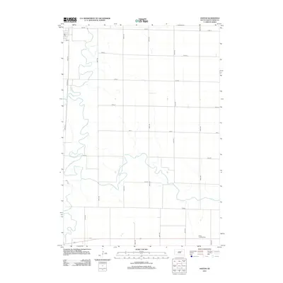
2012 Map of Ashton
USGS Topo · Published 2012About this map
The James River meanders heavily through this section of Spink County, defining the drainage patterns and historical agricultural boundaries of the eastern Dakota plains. In the northwest corner, a small cluster of activity is centered around Sun St, including a local Po, suggesting a centralized point for the surrounding rural community. The landscape is dominated by a rigid section-line road grid, typical of the Homestead Act's enduring legacy on the Midwest, with north-south routes like 387th Ave and 392nd Ave intersecting east-west roads such as 165th St. Aviation history and utility are noted in the southern portion of the quadrangle with the presence of the Deiter Landing Strip, while the seasonal flows of Snake Cr and Turtle Cr join the river's main channel, highlighting the hydrological complexity of this fertile river valley during the early 21st century.
Find a feature on this map
22 named features on this map. Tap any name to fly to it.
Don’t see what you’re looking for? This feature index may not catch every label — zoom into the map to look around manually.
Map Details
Editions of this 2012 Ashton Map
This is the sole edition of this map. No revisions or reprints were ever made.
Other maps of this area

1895 · Byron
USGS Topo · 1:125,000

1895 · Aberdeen
USGS Topo · 1:125,000

1899 · Northville
USGS Topo · 1:125,000

1899 · Redfield
USGS Topo · 1:125,000

1953 · Frankfort
USGS Topo · 1:24,000

1953 · Redfield North
USGS Topo · 1:24,000

1953 · Gallup
USGS Topo · 1:24,000

1953 · Ashton
USGS Topo · 1:24,000

1953 · Huron
USGS Topo · 1:250,000

1954 · Aberdeen
USGS Topo · 1:250,000