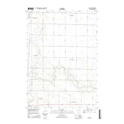
2015 Map of Ashton
USGS Topo · Published 2015About this map
The James River snakes through the center of this Spink County landscape, creating a complex series of oxbows and marshy bottomlands that contrast with the rigid grid of the surrounding agricultural prairie. At the northern edge, the community of Ashton is situated along the bends of the river and the Railroad Ln corridor, while the city of Redfield anchors the southwestern corner of the quadrangle. The terrain is further defined by the convergence of smaller waterways including Turtle Creek and Snake Creek, which drain into the larger James River valley. This 2015 survey illustrates how modern sectional roads like 165th St and 388th Ave have adapted to the meandering path of the river, leaving pockets of uncultivated land along the water's edge where the natural topography resisted the plow.
Find a feature on this map
29 named features on this map. Tap any name to fly to it.
Don’t see what you’re looking for? This feature index may not catch every label — zoom into the map to look around manually.
Map Details
Editions of this 2015 Ashton Map
This is the sole edition of this map. No revisions or reprints were ever made.
Other maps of this area

1895 · Byron
USGS Topo · 1:125,000

1895 · Aberdeen
USGS Topo · 1:125,000

1899 · Northville
USGS Topo · 1:125,000

1899 · Redfield
USGS Topo · 1:125,000

1953 · Frankfort
USGS Topo · 1:24,000

1953 · Redfield North
USGS Topo · 1:24,000

1953 · Gallup
USGS Topo · 1:24,000

1953 · Ashton
USGS Topo · 1:24,000

1953 · Huron
USGS Topo · 1:250,000

1954 · Aberdeen
USGS Topo · 1:250,000