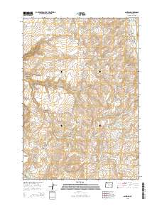
2014 Map of Ashwood
USGS Topo · Published 2014About this map
Ashwood serves as the focal point for this high-desert landscape in central Oregon, where narrow gulches and seasonal drainages define the settlement patterns. This area of Jefferson County is marked by a legacy of ranching and early orchards, visible in features like Clarke Orchard and the Woods Cem north of the main townsite. The terrain is deeply dissected by drainages such as Trout Cr and Wilson Cr, which flow between prominent basaltic formations like Hat Rock and Sand Mtn.
Find a feature on this map
42 named features on this map. Tap any name to fly to it.
Don’t see what you’re looking for? This feature index may not catch every label — zoom into the map to look around manually.
Map Details
Editions of this 2014 Ashwood Map
This is the sole edition of this map. No revisions or reprints were ever made.
Other maps of this area

1955 · Bend
USGS Topo · 1:250,000

1957 · Bend
USGS Topo · 1:250,000

1958 · Bend
USGS Topo · 1:250,000

1966 · Antelope
USGS Topo · 1:62,500

1966 · Willowdale
USGS Topo · 1:62,500

1968 · Axehandle Butte
USGS Topo · 1:24,000

1968 · Dutchman Creek
USGS Topo · 1:24,000

1968 · Ashwood
USGS Topo · 1:24,000
1969 · Brewer Reservoir
USGS Topo · 1:24,000
1969 · Foley Butte
USGS Topo · 1:24,000