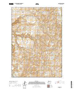
2020 Map of Ashwood
USGS Topo · Published 2020About this map
Ashwood serves as the primary focal point of this Jefferson County landscape, situated near the confluence of Trout Cr and Prineville Gulch. The terrain is defined by a dense network of drainages and named springs, such as Wright Spring, Lee Woods Spring, and Clarke Springs, which historically supported the isolated ranching and orchard operations in the area. Evidence of early settlement and land use is visible at Clarke Orchard and the Woods Cem near Woods Hollow.
Find a feature on this map
49 named features on this map. Tap any name to fly to it.
Don’t see what you’re looking for? This feature index may not catch every label — zoom into the map to look around manually.
Map Details
Editions of this 2020 Ashwood Map
This is the sole edition of this map. No revisions or reprints were ever made.
Other maps of this area

1955 · Bend
USGS Topo · 1:250,000

1957 · Bend
USGS Topo · 1:250,000

1958 · Bend
USGS Topo · 1:250,000

1966 · Antelope
USGS Topo · 1:62,500

1966 · Willowdale
USGS Topo · 1:62,500

1968 · Axehandle Butte
USGS Topo · 1:24,000

1968 · Dutchman Creek
USGS Topo · 1:24,000

1968 · Ashwood
USGS Topo · 1:24,000
1969 · Brewer Reservoir
USGS Topo · 1:24,000
1969 · Foley Butte
USGS Topo · 1:24,000