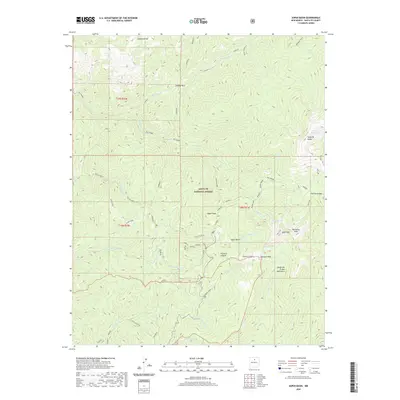
2020 Map of Aspen Basin
USGS Topo · Published 2020About this map
The high-elevation wilderness of the Santa Fe National Forest dominates this topographic study, where the peaks of the Sangre de Cristo Mountains define the local hydrology. Rising to prominent summits like Santa Fe Baldy and Tesuque Peak, the terrain gives way to deep alpine basins that feed an intricate network of waterways, including the Rio Nambe and the headwaters of the Santa Fe River. The map details a complex system of primitive trails such as the Windsor and Sky Line, which navigate through steep relief to reach remote high-altitude bodies of water like Lake Katherine and Nambe Lake. This 2020 landscape reveals the enduring character of northern New Mexico's protected lands, showing how trails like the Borrego and Chamisa provide access to the Aspen Basin and the lower reaches of Pacheco Canyon and Cañada Vaca.
Find a feature on this map
73 named features on this map. Tap any name to fly to it.
Don’t see what you’re looking for? This feature index may not catch every label — zoom into the map to look around manually.
Map Details
Editions of this 2020 Aspen Basin Map
This is the sole edition of this map. No revisions or reprints were ever made.
Other maps of this area

1889 · Santa Fe
USGS Topo · 1:125,000

1894 · Santa Fe
USGS Topo · 1:125,000

1952 · Santa Fe
USGS Topo · 1:24,000

1953 · Tesuque
USGS Topo · 1:24,000

1953 · Sierra Mosca
USGS Topo · 1:24,000
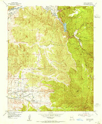
1953 · Cundiyo
USGS Topo · 1:24,000

1953 · Mc Clure Reservoir
USGS Topo · 1:24,000

1953 · Aspen Basin
USGS Topo · 1:24,000

1954 · Santa Fe
USGS Topo · 1:250,000

1958 · Santa Fe
USGS Topo · 1:250,000