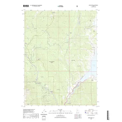
2020 Map of Aspen Grove
USGS Topo · Published 2020About this map
Mount Timpanogos anchors the western edge of this survey, overlooking the high-altitude settlements of Aspen Grove and Sundance. The landscape transitions from the high peaks of the Wasatch Range down toward the Deer Creek Reservoir in the east, revealing a dense network of recreational and seasonal infrastructure within the Uinta National Forest. The map documents a complex system of winter-access roads and alpine trails, such as the Alpine Loop Winter (Snow) and the Cascade Springs Winter (Snow) route, which bypasses Bear Canyon and Thomas Canyon. Along the southern border, the Provo River cuts through the deep corridor of Provo Canyon, while to the north, drainage from Mill Canyon Peak feeds into a series of named springs like Rock Spring and Mill Canyon Spring. This record provides a detailed look at the modern footprint of these mountain resorts, including specific road alignments like Brickerhaven Dr and the Lower Lift Rd serving the local slopes.
Find a feature on this map
72 named features on this map. Tap any name to fly to it.
Don’t see what you’re looking for? This feature index may not catch every label — zoom into the map to look around manually.
Map Details
Editions of this 2020 Aspen Grove Map
This is the sole edition of this map. No revisions or reprints were ever made.
Other maps of this area

1885 · Salt Lake
USGS Topo · 1:250,000

1900 · Coalville
USGS Topo · 1:125,000

1903 · Coalville
USGS Topo · 1:125,000

1907 · Strawberry Valley
USGS Topo · 1:125,000

1909 · Strawberry Valley
USGS Topo · 1:125,000

1925 · Ft. Douglas
USGS Topo · 1:125,000

1928 · Ft. Douglas
USGS Topo · 1:125,000

1948 · Timpanogos Cave
USGS Topo · 1:24,000

1948 · Orem
USGS Topo · 1:24,000

1948 · Orem
USGS Topo · 1:62,500