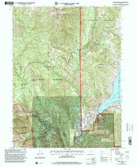
1998 Map of Aspen Grove
USGS Topo · Published 2000About this map
Mount Timpanogos anchors the western edge of this 1990s landscape, serving as a focal point for the Uinta National Forest and the surrounding high-altitude terrain. The map details the developed recreation and research infrastructure near the settlement of Aspen Grove, including the Aspen Grove Recreation Complex, a Snow Gaging Station, and the uniquely named The Theater in the Pines. To the east, the waters of the Deer Creek Reservoir and the Provo River flow through the Deer Creek State Recreation Area, illustrating the region's importance for water storage and outdoor activity.
Find a feature on this map
45 named features on this map. Tap any name to fly to it.
Don’t see what you’re looking for? This feature index may not catch every label — zoom into the map to look around manually.
Map Details
Editions of this 1998 Aspen Grove Map
This is the sole edition of this map. No revisions or reprints were ever made.
Other maps of this area

1885 · Salt Lake
USGS Topo · 1:250,000

1900 · Coalville
USGS Topo · 1:125,000

1903 · Coalville
USGS Topo · 1:125,000

1907 · Strawberry Valley
USGS Topo · 1:125,000

1909 · Strawberry Valley
USGS Topo · 1:125,000

1925 · Ft. Douglas
USGS Topo · 1:125,000

1928 · Ft. Douglas
USGS Topo · 1:125,000

1948 · Timpanogos Cave
USGS Topo · 1:24,000

1948 · Orem
USGS Topo · 1:24,000

1948 · Orem
USGS Topo · 1:62,500