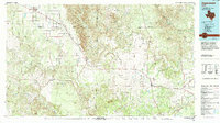
1985 Map of Aspermont
USGS Topo · Published 1994About this map
The Salt Fork Brazos River and its numerous tributaries dominate this landscape across Stonewall, Kent, and Dickens Counties. At the center of the sheet, the convergence of the North Fork and South Fork of the Double Mountain Fork Brazos River reveals a rugged drainage system characteristic of the Texas Rolling Plains. Small agricultural and oil-producing communities such as Aspermont and Jayton anchor the region's transportation network.
Find a feature on this map
32 named features on this map. Tap any name to fly to it.
Don’t see what you’re looking for? This feature index may not catch every label — zoom into the map to look around manually.
Map Details
Editions of this 1985 Aspermont Map
This is the sole edition of this map. No revisions or reprints were ever made.
Other maps of this area

1891 · Anson
USGS Topo · 1:125,000

1893 · Roby
USGS Topo · 1:125,000

1893 · Anson
USGS Topo · 1:125,000

1925 · Aspermont 4-a
USGS Topo · 1:48,000

1925 · Haskell 3-b
USGS Topo · 1:48,000

1926 · Snyder 1-a
USGS Topo · 1:48,000

1926 · Roby 2-b
USGS Topo · 1:48,000

1931 · Rotan
USGS Topo · 1:62,500

1931 · Aspermont
USGS Topo · 1:62,500

1932 · Camp Springs
USGS Topo · 1:62,500