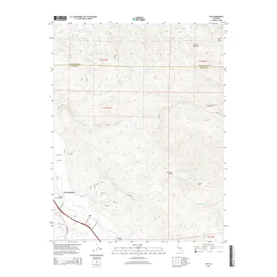
2015 Map of Asti
USGS Topo · Published 2015About this map
The Russian River carves through this northern California landscape, defining the fertile corridor of the Alexander Valley and the western edge of the Mayacmas Mountains. To the north, the settlement of Cloverdale serves as a hub of transportation and activity, anchored by the Cloverdale Municipal Airport. Further south along the river lies the smaller community of Asti, where local infrastructure like Asti Post Office Rd and Washington School Rd suggest the rural development of the era. The terrain transitions quickly from the river valley into steep ridges, including the prominent Pine Mtn and Pocket Peak. Numerous drainage systems like Little Sulphur Cr and Crocker Cr cut through the hills, while named canyons like Devils Den Canyon illustrate the complex geography of the Sonoma and Mendocino county borderlands.
Find a feature on this map
48 named features on this map. Tap any name to fly to it.
Don’t see what you’re looking for? This feature index may not catch every label — zoom into the map to look around manually.
Map Details
Editions of this 2015 Asti Map
This is the sole edition of this map. No revisions or reprints were ever made.
Other maps of this area

1920 · Healdsburg
USGS Topo · 1:62,500

1921 · Skaggs
USGS Topo · 1:62,500

1921 · Kelseyville
USGS Topo · 1:62,500

1933 · Healdsburg
USGS Topo · 1:48,000

1938 · Hopland
USGS Topo · 1:62,500

1940 · Healdsburg
USGS Topo · 1:62,500

1943 · Skaggs Springs
USGS Topo · 1:24,000

1943 · Kelseyville
USGS Topo · 1:62,500

1943 · Hopland
USGS Topo · 1:62,500

1944 · Skaggs Springs
USGS Topo · 1:31,680