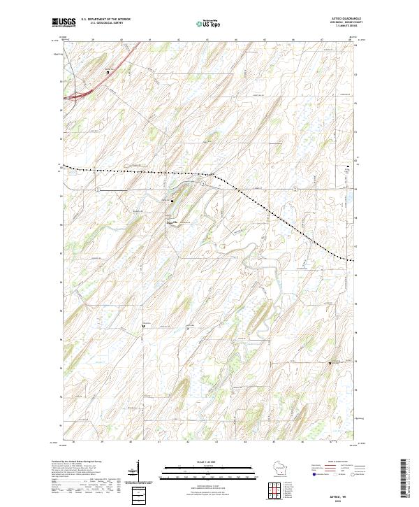
2022 Map of Astico
USGS Topo · Published 2022About this map
The Crawfish River winds through this rural landscape of Dodge County, where the small settlements of Astico and Danville serve as central points for a surrounding agricultural network. This 2022 survey illustrates a region defined by its watercourses and a high density of rural burial grounds, reflecting the deep multi-generational roots of the local community. Genealogists and local historians can locate several family and community landmarks, including Bethel Cem in the northwest, Grove Prairie Cem to the east, and Austin Cem near the center of the sheet. The terrain is marked by distinct drainages like Calamus Cr and Nolan Cr, while the winding Ghost Hill Rd hints at the local character of the glacial drumlin topography. The intersection of county roads and local ways like Wexford Rd and Drolshagen Rd shows how the land has been partitioned and navigated for over a century.
Find a feature on this map
72 named features on this map. Tap any name to fly to it.
Don’t see what you’re looking for? This feature index may not catch every label — zoom into the map to look around manually.
Map Details
Editions of this 2022 Astico Map
This is the sole edition of this map. No revisions or reprints were ever made.
Other maps of this area

1890 · Sun Prairie
USGS Topo · 1:62,500

1891 · Waterloo
USGS Topo · 1:62,500

1894 · Waterloo
USGS Topo · 1:62,500

1896 · Sun Prairie
USGS Topo · 1:62,500

1905 · Sun Prairie
USGS Topo · 1:62,500

1907 · Sun Prairie
USGS Topo · 1:62,500

1910 · Waterloo
USGS Topo · 1:62,500

1955 · Columbus
USGS Topo · 1:62,500

1955 · Beaver Dam
USGS Topo · 1:62,500

1957 · Madison
USGS Topo · 1:250,000