
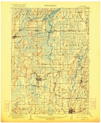
1910 Map of Waterloo
USGS Topo · Published 1910About this map
Crawfish River and Rock River dominate this Jefferson County landscape, winding through a network of wetlands and early 20th-century farmsteads. The region's transport economy is clearly visible, with the Chicago and Northwestern RR and the Chicago Milwaukee and St. Paul RR creating vital connections at Jefferson Junction. Settlement is concentrated around the shores of Rock Lake at Lake Mills, while smaller outposts like Hubbleton, Favilles Grove, and Aztalan represent the agricultural and milling hubs of the era.
Find a feature on this map
49 named features on this map. Tap any name to fly to it.
Don’t see what you’re looking for? This feature index may not catch every label — zoom into the map to look around manually.
Map Details
Editions of this 1910 Waterloo Map
2 editions found
Other maps of this area

1890 · Sun Prairie
USGS Topo · 1:62,500

1890 · Stoughton
USGS Topo · 1:62,500

1891 · Waterloo
USGS Topo · 1:62,500

1891 · Koshkonong
USGS Topo · 1:62,500

1892 · Watertown
USGS Topo · 1:62,500

1892 · Whitewater
USGS Topo · 1:62,500

1893 · Whitewater
USGS Topo · 1:62,500

1894 · Waterloo
USGS Topo · 1:62,500

1894 · Watertown
USGS Topo · 1:62,500

1894 · Koshkonong
USGS Topo · 1:62,500