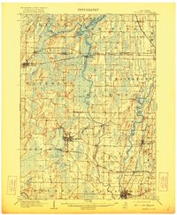
1910 Map of Waterloo
USGS Topo · Published 1921About this map
The Crawfish River and Rock River valley systems define the agricultural and industrial layout of Jefferson County in the early twentieth century. As the Chicago Milwaukee and St. Paul RR and the Chicago and Northwestern RR cross the landscape, they anchor key hubs like the city of Jefferson and the village of Waterloo. The map reveals a high density of small-scale rural infrastructure, from the riverside placement of Hoopers Mill to the railroad intersections at Jefferson Junction and Hubbleton.
Find a feature on this map
45 named features on this map. Tap any name to fly to it.
Don’t see what you’re looking for? This feature index may not catch every label — zoom into the map to look around manually.
Map Details
Editions of this 1910 Waterloo Map
2 editions found

Other maps of this area

1890 · Sun Prairie
USGS Topo · 1:62,500

1890 · Stoughton
USGS Topo · 1:62,500

1891 · Waterloo
USGS Topo · 1:62,500

1891 · Koshkonong
USGS Topo · 1:62,500

1892 · Watertown
USGS Topo · 1:62,500

1892 · Whitewater
USGS Topo · 1:62,500

1893 · Whitewater
USGS Topo · 1:62,500

1894 · Waterloo
USGS Topo · 1:62,500

1894 · Watertown
USGS Topo · 1:62,500

1894 · Koshkonong
USGS Topo · 1:62,500