
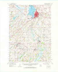
1955 Map of Beaver Dam
USGS Topo · Published 1957About this map
Beaver Dam and its eponymous lake anchor this mid-century portrait of Dodge County's dairy and agricultural landscape. The city is a hub of industry and transit, served by the Chicago and North Western and Milwaukee St Paul and Pacific railroads. Outside the city center, the landscape is defined by the Beaverdam River and the expansive Shaw Marsh, while the west is dominated by the waters of Lost Lake.
Find a feature on this map
78 named features on this map. Tap any name to fly to it.
Don’t see what you’re looking for? This feature index may not catch every label — zoom into the map to look around manually.
Map Details
Editions of this 1955 Beaver Dam Map
2 editions found
Other maps of this area

1890 · Sun Prairie
USGS Topo · 1:62,500

1891 · Waterloo
USGS Topo · 1:62,500

1892 · Watertown
USGS Topo · 1:62,500

1894 · Waterloo
USGS Topo · 1:62,500

1894 · Watertown
USGS Topo · 1:62,500

1896 · Sun Prairie
USGS Topo · 1:62,500

1905 · Sun Prairie
USGS Topo · 1:62,500

1907 · Sun Prairie
USGS Topo · 1:62,500

1910 · Waterloo
USGS Topo · 1:62,500

1955 · Randolph
USGS Topo · 1:62,500